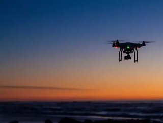
Emesent commercializes first underground drone technology for mine mapping
An Australian mine technology solutions provider spun out from a leading innovation developer, has commercialised its first market ready product.
Emesent, a drone autonomy company spin-out from Commonwealth Scientific and Industrial Research Organisation (CSIRO), has raised $3.5mn in venture capital to commercials its Hovermap solution.
Hovermap is a LiDAR mapping and autonomy payload, providing a complete solution for inspection and mapping of underground mines, transport tunnels and utility tunnels. The idea of Hovermap is to automate the collection of valuable data in underground areas deemed too dangerous or difficult for people to survey and navigate.
The technology will be implemented into a drone solution and deployed in GPS-denied environments without a human controller to create 3D maps, record gas readings, videos and images.
Related stories:
Airobotics raises capital to $101mn to bring pilotless drones to the mining industry
Airobotics partners with Rockblast to bring automated drones to Chile
Airware enhances its drone solution offering to the mining world
Reach for the sky: Airware and the future of drones in the mining industry
Hovermap draws on a decade of research by CSIRO's Robotics and Autonomous Systems group into drone autonomy and 3D LiDAR-based simultaneous localisation and mapping (3D SLAM) techniques.
"Hovermap enables the mining industry to safely inspect inaccessible areas of underground mines, while improving the type and quality of data collected to unlock new insights," Dr Stefan Hrabar, co-founder and CEO of Emesent said.
"This includes comparing the stope design to the actual post-blast shape to detect over-break and under-break, identification of geotechnical structures and accurate post-blast volume reconciliations.
"The data we gather improves a mine's productivity and provides a better understanding of conditions underground, all without sending surveyors and miners into potentially hazardous areas."
Last year, Hovermap enabled the world's first fully autonomous beyond line-of-sight drone flight in an underground mine, 600 metres below the surface of Western Australia.
Emesent's Hovermap system is already being used commercially for a variety of applications by early adopters in Australia, the US, Canada, China and Japan.